Lake Erie Bluff Recession

Bluff Recession
Approximately 90 percent of Pennsylvania’s Lake Erie shoreline is subject to bluff recession. Pennsylvania Sea Grant funded research explores the challenges and offers solutions.
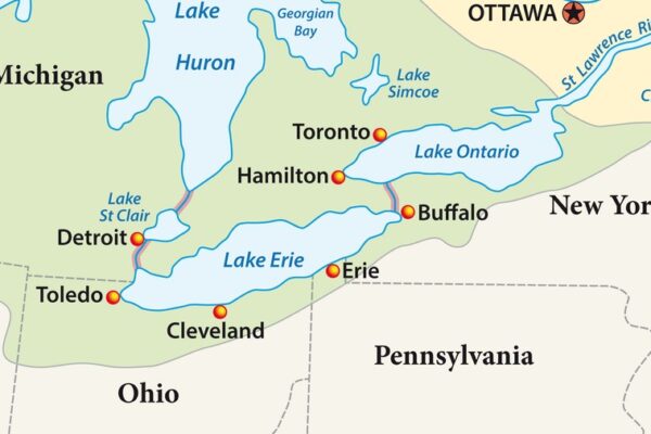
Four states including Pennsylvania and the Canadian province of Ontario all border Lake Erie. The Pennsylvania Lake Erie shoreline is known for its beaches, wildlife, and scenic bluff views. Unfortunately, the shoreline is changing.
Approximately 76.6 miles of Lake Erie shoreline lies within Pennsylvania’s borders. The topography of the area varies from sandy beaches, to protected wildlife habitat areas, and water-and-weather carved bluffs that stand 180 feet above the water level. The bluffs were formed nearly 2.6 million years ago and make up ninety-percent of the shoreline. They consist of loosely arranged sediment, which makes the shoreline highly susceptible to recession. Bluff recession refers to the loss of material along the bluff face, which can occur naturally by high water levels, currents, waves, weather, and even gravity. This naturally occurring recession is exacerbated by human activities such as land development.
Given the economic and environmental impacts associated with bluff retreat, there is a need for high-resolution bluff monitoring data, better understanding of bluff dynamics, and updated bluff management guidance for municipalities and property owners.
Researchers from Pennsylvania Sea Grant and Penn State Erie have completed in-depth research studies of the bluffs and developed tools to help homeowners and decision-makers prepare, plan, and prevent bluff recession. Read more about the research.
Visit our Videos and Media page to watch a five-part webinar series about bluff recession.
JANUARY 2025
This research was conducted along the shores of Lake Erie in Erie, PA to improve understanding of the relationships between coastal processes, hazards, and sediment supply associated with bluff retreat on the Lake Erie coast. The Principal Investigator was Anthony Foyle, Ph.D., Penn State Erie, the Behrend Campus, Erie, PA. Photos courtesy of the Pennsylvania Department of Environmental Protection.


